Apps to View Satellite Images
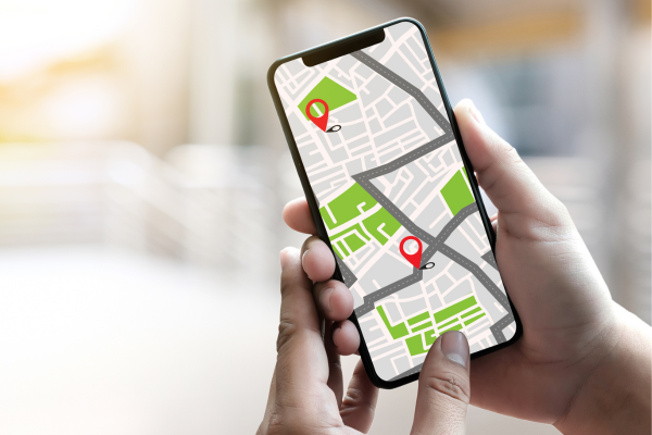
Apps to view satellite images have become indispensable tools for various purposes, such as navigation, urban planning, agriculture, environmental monitoring, and even personal curiosity.
With technological advancements, accessing high-resolution images of Earth directly from your smartphone or computer is now possible, unlocking a world of possibilities previously limited to specialists.
Why Use Apps to View Satellite Images?
Satellite imaging apps offer numerous advantages that can transform simple daily tasks or more complex professional projects. Here are some reasons to use them:
- Travel planning: Visualize routes, regions, and tourist spots in advance.
- Area monitoring: Whether for agriculture, terrain analysis, or environmental studies, these images help understand space details.
- World exploration: Discover landscapes, cities, and natural phenomena without leaving home.
- Practicality and accessibility: Many apps are free and feature user-friendly interfaces, even for beginners.
Moreover, many of these apps offer premium versions, including features like real-time imagery, advanced data analysis, and interactive tools, providing even more precision and resources.
The Best Apps to View Satellite Images
Below is a list of some of the most renowned and reliable apps available today:
1. Google Earth
Google Earth is a global reference for exploring satellite images. It allows users to view any location in the world in high quality, create custom projects, and access historical data.
Highlights:
- Free access.
- 3D images, providing a realistic view.
- Regularly updated data.
- Tools like “Voyager,” offering interactive guided tours.
2. Google Maps
Best known as a navigation app, Google Maps is also an excellent tool for viewing satellite images. It combines accuracy with features like Street View, allowing detailed exploration of locations.
Highlights:
- Seamless integration with navigation routes.
- Detailed images and frequent updates.
- Useful tool for drivers, travelers, and explorers.
3. NASA Worldview
NASA Worldview caters to those needing technical and detailed information on climate and environmental phenomena. It provides near real-time satellite imagery from NASA satellites, making it an essential tool for scientists and professionals.
Highlights:
- Monitoring natural disasters such as hurricanes and wildfires.
- Reliable scientific data.
- Advanced interface designed for technical analysis.
4. Zoom Earth
If you’re looking for an immersive experience, Zoom Earth is a great option. It combines high-resolution images with real-time visualization of weather phenomena.
Highlights:
- Updated visuals of hurricanes, storms, and weather conditions.
- Simple and intuitive navigation.
- Ideal for tracking live events.
5. Sentinel Hub
Sentinel Hub is a powerful tool designed for environmental monitoring and agriculture. With access to data from the European Space Agency (ESA) satellites, it is widely used by specialists.
Highlights:
- Advanced analytical tools.
- Perfect for vegetation, soil, and climate studies.
- Compatible with scientific research.
6. Here WeGo
Another app that combines navigation and satellite images, Here WeGo is a practical solution for drivers and travelers. It allows offline navigation, which is useful in areas with limited connectivity.
Highlights:
- Detailed maps and updated images.
- Real-time traffic information.
- Easy to use for travel purposes.
How to Choose the Ideal App?
Choosing the ideal app depends on your needs. Consider the following factors:
- General use: For a complete and accessible experience, opt for Google Earth or Google Maps.
- Environmental monitoring: NASA Worldview and Sentinel Hub are better suited for technical and scientific analyses.
- Real-time updates: Zoom Earth stands out for providing continuously updated data.
- Navigation: Here WeGo is ideal for drivers needing detailed maps with offline support.
Tips for Using Satellite Imaging Apps
- Explore additional features: Many apps offer extra features like creating custom projects, 3D visualization, and historical data integration.
- Stay updated: Use the latest version of the app to ensure access to the most recent images and the best performance.
- Respect usage terms: Check permissions for commercial use, especially if you plan to use images for business or studies.
Benefits of Using Apps to View Satellite Images
The benefits are vast and apply to both personal and professional uses. Among them:
- Efficient planning: Essential for architects, engineers, and farmers.
- Virtual exploration: Discover incredible places without leaving your home.
- Environmental monitoring: Track climate changes, natural disasters, and vegetation patterns.
- Accessibility: With many free options, these tools are within everyone’s reach.
Future Trends for Satellite Imaging Apps
With advancements in artificial intelligence and machine learning, apps are becoming even more precise. Some trends include:
- Ultra-high-definition real-time imagery.
- Integration with drones for detailed analyses.
- Environmental scenario simulation to predict disasters and climate changes.
Apps to view satellite images offer a fascinating perspective of the planet, catering to a wide range of needs.
Whether for exploring the world, planning projects, or conducting advanced studies, these tools are indispensable in today’s world. Try the listed apps and find the one that best suits your needs!